Download
1 / 18
180 likes | 355 Views
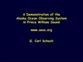
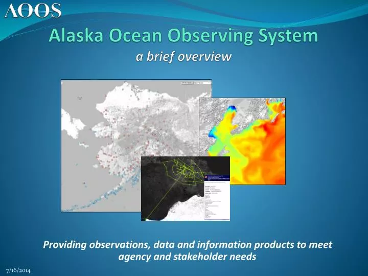
Alaska Ocean Observing System a brief overview. Providing observations, data and information products to meet agency and stakeholder needs. What is AOOS?. Part of a national network with the mission of observing the ocean in 4-D and providing easy access to marine data Primary Activities:

E N D
Alaska Ocean Observing Systema brief overview Providing observations, data and information products to meet agency and stakeholder needs
What is AOOS? Part of a national network with the mission of observing the ocean in 4-D and providing easy access to marine data Primary Activities: Host a centralized data clearing house with web-based tools and data products Work with marine users to fill gaps in ocean monitoring Foster collaborations to meet multiple stakeholder needs
Philosophy Congressionally directed, stakeholder driven, science-based Measure once, use many times Data management: Open source system with High Performance Computing (HPC) & Integrated Data Lifecycle Stewardship Highly leveraged: partners are essential! To date: focused on data access & integration; now looking to increase observing capacity e.g. real-time sensors, models, and observing platforms; support observations in central GOA, Bering Sea and Arctic
1 Structure 7 Part of the Integrated Ocean Observing System (IOOS) Governed through a Memorandum of Agreement Fiscal agent: Alaska SeaLife Center Board Executive Committee: AK Marine Exchange: Ed Page, chair AK Dept of Natural Resources: Ed Fogels, vice-chair Barrow Arctic Science Consortium: Glenn Sheehan, secretary NOAA Regional Team: Amy Holman, treasurer Other Members: AK Sea Grant Program, AK SeaLife Center,AK Dept of Fish & Game, AK Department of Environmental Conservation, Bureau of Ocean Energy Management, NOAA AK Fishery Science Center, North Pacific Fishery Management Council, North Pacific Research Board, Prince William Sound Science Center/OSRI, Shell Oil, University of Alaska, US Arctic Research Commission, US Coast Guard, US Geological Survey, World Wildlife Fund 5 3 8 6 9 10 11 4 2
What does AOOS do? Marine Operations Maintains 8 weather stations in Prince William Sound & 1 in Cook Inlet, streaming weather data and webcams Wind (WRF) and circulation (ROMS) forecasts in Prince William Sound and Cook Inlet, & validating hydrological model in PWS Cook Inlet wave buoy, providing real time sea conditions to mariners & forecasters High Frequency radars in Chukchi Sea to monitor surface currents Supports Deployment of seasonal wave buoy in Bering Sea Collaborates With the Marine Exchange of Alaska to implement Automatic Identification System (AIS) transmitters to disseminate real-time weather data, buoy data, and weather forecasts to vessels
What does AOOS do? Coastal Hazards Created Alaska Harbor Observation Network (AHON) with Seward and Kodiak stations: stream weather & web cams at harbors Funded ice radar installation in Barrow to monitor Arctic sea ice, now maintained with other funding Facilitating working group to increase sea level rise observations for western AK Developing archived website for coastal beach profiles Support tide gauge in Bristol Bay Developing electronic sea ice atlas for historical data since the1850s Maintains Cook Inlet and Bering Sea wave buoys
What does AOOS do? Ecosystems, Fisheries & Climate Trends Contributes funding to the Seward Line in the Gulf of Alaska, providing a critical long-term data series & climate trends twice per year on oceanographic conditions Maintains an underwater autonomous gliderto monitor ocean conditions and water flow in the Arctic: will test hydrophone to record marine mammal calls Supports statewide ocean acidification monitoring by sampling for OA along the Seward Line, and contributing to a consortium supporting OA moorings in the Gulf of Alaska, Bering Sea, and Arctic Develops and maintains an electronic sea ice atlas showing weekly sea ice since the 1850s to the present Partnering with NOAA to collect oceanographic data along transects in Kachemak Bay and lower Cook Inlet to support new circulation forecast model and understand ocean acidification. Facilitating development of new animal tagging network in Arctic Support ocean acidification monitoring network and developing Gulf of AK OA forecast
What does AOOS do? Data Management & Information Products Maintains AOOS website and data portal Real-time Sensor Map Model Explorer Research Assets Map Arctic Data Portal Cook Inlet Response Tool Research Workspace Seabird Portal Herring Portal Industry Arctic Data
Real-Time Sensor Map Air temp Barometric Pressure Currents Water level Precipitation Salinity Snow depth Stream flow Stream height Tides Water temp Web cams Weather Wind More…. Over 4,000 sensors statewide
Real-Time Sensor Map Graphs of the latest 24 hr trend when you mouse-over
Model Explorer • Gridded data including models and satellite observations • Over 100 distinct layers • Browse by category or keyword • Now iPhone/iPad friendly
Research Assets Map • Goals of the map • Assist research planning • Reduce duplication of effort • Avoid collisions • See holistic picture What instruments are deployed and what are they collecting? Started in the Arctic, now expanding statewide
Arctic Portal Polar projection Handles many data types More than 200 layers • GIS/project type data • Satellite imagery • Real-time sensors • Forecast models Visualize data stacks Explore by time Download data
Cook Inlet Response Tool ShoreZone • Integrates: • Geographic Response Strategies • Oil Persistence estimates • Biological data • ShoreZone imagery and video • Real-time conditions • And more….
Research Workspace Web-based data management system for assembling, storing, and sharing data between members of biological and physical oceanography communities. Users can: • Create projects • Create metadata • Upload data (drag and drop) • Share or download data • View all of the projects, folders, and files uploaded by other group members • Track history of data management within the project • Next steps: add new functions including automated archive to NODC, incorporate data into AOOS Ocean Portal Search Tool, capability to publish to publish data from researcher access only to completely public access • Current User Groups: Gulf Watch AK, GOAIERP, RUSALCA, others
Upcoming new projects (FY13) Ocean Acidification Forecast for Gulf of Alaska Northeast Chukchi Sea Mooring, fully instrumented Arctic Acoustic Call Library Wave Sensor in the Beaufort Sea Water Level Monitoring in Southwest Alaska
www.aoos.org Executive Director: Molly McCammon, mccammon@aoos.org Program Managers: Darcy Dugan, dugan@aoos.org Ellen Tyler, tyler@aoos.org Data Manager: Rob Bochenek, rob@axiomalaska.org Please let us know if you would like a small group tutorial on our data tools or more information on our program