Download
1 / 24
240 likes | 400 Views
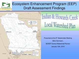
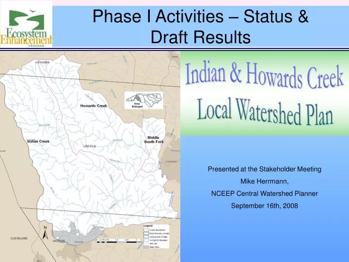
Phase I Activities – Status & Draft Results. Presented at the Stakeholder Meeting Mike Herrmann, NCEEP Central Watershed Planner September 16th, 2008. Phase I Activities & Products. Objective: Begin Characterizing Watershed Conditions Process:. Field and GIS inventory

E N D
Phase I Activities – Status & Draft Results Presented at the Stakeholder Meeting Mike Herrmann, NCEEP Central Watershed Planner September 16th, 2008
Phase I Activities & Products Objective: Begin Characterizing Watershed Conditions Process: • Field and GIS inventory • Delineate and characterize drainages • Assess Functions • Form stakeholder group • Review existing Monitoring data Products: • Critical data gaps identified • Goals for the LWP • Potential hotspots & projects • Monitoring & fieldwork plans • Preliminary Assessment Report
Phase I Assessment Habitat Assessment Factors • Diverse aquatic & terrestrial communities • Forested riparian areas, floodplains • Abundant aquatic microhabitat • Stable streambanks • Diverse channel substrate • Terrestrial travel corridors that promote wildlife movement • Minimally fragmented forest • Adequate resources (food, shelter, and community) • Does not endanger or threaten native species.
Phase I Assessment Water Quality Assessment Factors • Chemicals, pathogens, and sediments in streams. • Monitor stream biology (i.e., bugs and fish) as a long-term indicators of water quality. • Meeting designated use (e.g., Aquatic life, recreation, or water supply). • Hospitable streams for aquatic life (e.g., good riparian habitat
Phase I Assessment Hydrology Assessment Factors • Effectively transporting water and sediment. • Vertically stable (i.e. Low bank-height ratios to allow access to floodplains) • Laterally stable streambanks • Riparian zones promoting groundwater recharge and sediment deposition. • Higher base flows and lower peak flows.
Phase I Assessment Habitat, Hydrology, & Water Quality Indicators
Phase I Assessment Assessment Unit - Subwatersheds • Provides a better spatial characterization of conditions within the Local Watershed Plan (LWP) area • Gives a context to compare areas within the LWP • Helps establish the need and type of follow-up fieldwork needed to more completely assess the subwatershed. • Criteria based on size, stream order, and land cover.
Phase I Assessment Subwatersheds Min. Size - 1.3mi2 Max. Size - 5.3mi2 Avg. Size - 3.4mi2
Phase I Assessment Land Cover • Updated 1996 NC Land Cover using 2005 aerial imagery • Minimum Mapping Unit of 4 acres • 6 Land Cover Categories
Phase I Assessment Land Cover
Phase I Assessment Habitat High Quality Habitat • Significant Natural Heritage Areas & Natural Heritage Element Occurrences • Interior Forest Cover (300 feet from forest edge) • Forested Wetlands & Hydric Soils • Forested Floodplains/Riparian Areas Hexastylis naniflora (Dwarf flowered Heartleaf). Forested Riparian Corridor, Lower Indian Creek
Phase I Assessment Habitat – Draft Results High Quality Habitat
Phase I Assessment Habitat High Quality Riparian Conditions • Typically 3000 feet or longer • Wide (>200 ft.) contiguous forested stream buffers • Mature riparian forest cover • Adjacent to an SNHA Forested Riparian Corridor, Mill Creek
Phase I Assessment Habitat – Draft Results High Quality Riparian Conditions
Phase I Assessment Hydrology Forested floodplain & riparian area • FEMA delineated 100-year floodplains • Headwaters riparian zones (90ft) • Forest & shrub considered “Forests) 100-year floodplain Floodplain Conditions, Middle Indian Creek
Phase I Assessment Hydrology – Draft Results Forested floodplain & riparian area
Phase I Assessment Water Quality Impacted Streams • Highly altered streams (e.g., channelized, denuded buffer) • 1000 ft or greater in length • Identified from aerial photography Impacted Riparian Zone, Tributary to Lower Indian Creek
Phase I Assessment Water Quality – Draft Results Impacted Streams
Phase I Assessment Water Quality Impacted Wetlands & Hydric Soils • Impacted NWI wetlands, hydric soils (Worsham) & visibly wet areas • Reduced capacity to filter runoff and trap sediments. • Impacts include ditching, removal of vegetation, cattle access • Identified from aerial photography Impacted Hydric Soils-Adjacent to South Fork
Water Quality – Draft Results Phase I Assessment Impacted Wetlands & Hydric Soils
Phase I Assessment Watershed Assessment – Draft Results • Habitat – Limited areas of high quality habitat • Hydrology – Conditions slightly better in Indian Creek than Howard’s • Water Quality • Indian Creek watershed impairment • Howard’s Creek compares poorly with Indian Creek for riparian & wetland conditions • Limited Monitoring Data • Subwatershed Functional Assessment – To Be Completed
Phase I Assessment Phase II Planning ENTRIX, Inc Contracted for Fieldwork Support: • Stream Preservation • Wetland Restoration • Stream Restoration • Stormwater BMPs • Agricultural BMPs
Phase I Assessment Phase II Planning • Finalizing Monitoring Plan • Developing Fieldwork Plan • Entrix under contract to complete the following assessments
- - - - - - - - - - Project Timeline Planning Process Begins Winter 2008 Form Stakeholder Group Monitoring Begins Develop Preliminary Findings Summer 2008 Phase 1 Activities End Fieldwork (Stream, Wetland, Stormwater, Ag BMPs) Data Analysis/Summaries Winter 08/09 Water Quality, Biologic Monitoring Monitoring Summary Report Watershed Finding Reports Phase 2 Activities End Summer 2009 Final Reports • Atlas of Project Sites • Final Assessment and Recommendations Final Public Meetings Phase 3 Activities End Winter 09/10 Plan Implementation