1 / 8

Regional Public Safety Mapping System

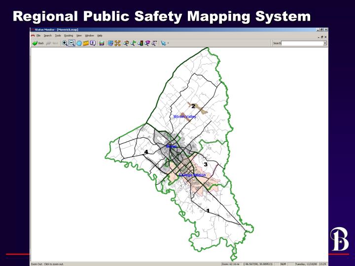
Access the Bryan GIS public safety mapping system to stay informed of incidents through the interactive "Pin Map" feature. This tool combines regional data and police blotter updates for quick visualization and analysis of safety information in your area.

kacia
Download Presentation

Regional Public Safety Mapping System

An Image/Link below is provided (as is) to download presentation Download Policy: Content on the Website is provided to you AS IS for your information and personal use and may not be sold / licensed / shared on other websites without getting consent from its author. Content is provided to you AS IS for your information and personal use only. Download presentation by click this link. While downloading, if for some reason you are not able to download a presentation, the publisher may have deleted the file from their server. During download, if you can't get a presentation, the file might be deleted by the publisher.

E N D

More Related