Download
1 / 1
40 likes | 302 Views
Managing Water Resources With GIS. Pros to a GIS system: --Greater communication and cooperation between users. --Information can be constantly changed and updated. --faster and more accurate than earlier methods. Cons to a GIS system: --expensive --complex, requires trained

E N D
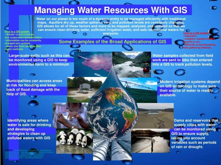
Managing Water Resources With GIS Pros to a GIS system: --Greater communication and cooperation between users. --Information can be constantly changed and updated. --faster and more accurate than earlier methods. Cons to a GIS system: --expensive --complex, requires trained experts to run. --difficulty of synchronizing data gathering methods. Some Examples of the Broad Applications of GIS Large-scale spills such as this can be monitored using a GIS to keep environmental harm to a minimum Water samples collected from field work are sent to labs then entered into a GIS to track pollution levels. Municipalities can access areas at risk for flooding and keep track of flood damage with the help of GIS. Modern irrigation systems depend on GIS technology to make sure their source of water is readily available. Water on our planet is too much of a dynamic entity to be managed efficiently with traditional maps. Aquifers dry up, weather patterns vary, and pollution levels are constantly changing. GIS allows for all of these factors and more to be mapped, analyzed, and updated so that we can ensure clean drinking water, sufficient irrigation water, and safe recreational waters for everyone. Identifying areas where water is safe for drinking and developing strategies to clean up polluted waters with GIS Dams and reservoirs that supply cities with water can be monitored using GIS to ensure supply, taking into account variables such as periods of rain or drought. Sources: www.clarkson.edu , www.awra.org , www.jcema.org www.oznet.ksu.edu , www.pageweavers.com , www.dof.virginia.gov www.danheller.com , www.conservation-ontario.on.ca , www.lanes.ac.uk , www.oxfam.org.uk , www.iaea.org , www.environment.ky.gov , www.shanghaidaily.com