Download
1 / 38
420 likes | 1.13k Views
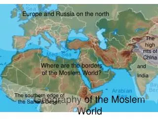
Unit 2: Physical Geography. Mastering the World Geography TEKS for the EOC. A World Gazetteer: A Look at the Seven Continents . TEKS Covered in this Section: Geography 9 The student understands the concept of region as an area of Earth’s surface with related geographic characteristics.

E N D
Unit 2: Physical Geography Mastering the World Geography TEKS for the EOC
A World Gazetteer: A Look at the Seven Continents • TEKS Covered in this Section: • Geography 9 The student understands the concept of region as an area of Earth’s surface with related geographic characteristics. • Geography 9 (A) Identify physical and/or human factors such as climate, vegetation, language, trade networks, political units, river systems, and religion, that constitute a region. • Geography 9 (B) Describe different types of regions, including formal … regions. • Social Studies Skills 21 (B) Locate places of contemporary geopolitical significance on a map. • Social Studies Skill 22 (C) Use geographical terminology correctly.
A World Gazetteer: A Look at the Seven Continents • Important Ideas • Five Oceans • Atlantic, Pacific, Indian, Arctic and Southern • Seven Continents • Africa, Antarctica, Asia, Australia, Europe, North America and South America • Latitude, landforms, and nearness to bodies of water greatly affect climate • Landforms, soil and climate greatly affect the plants and animals that can be found in each place
A World Gazetteer: A Look at the Seven Continents North America • World’s third largest continent • Located in the Western Hemisphere • Bordered by the Atlantic, Pacific and Arctic Oceans and the Gulf of Mexico
A World Gazetteer: A Look at the Seven Continents North America • West Indies • Large number of Islands in the Caribbean Sea
A World Gazetteer: A Look at the Seven Continents North America • Physical Features • Mountains • Rocky Mountains • Appalachian Mountains • Bodies of Water • St. Lawrence River • Mississippi River • The Great Lakes • Rio Grande • Panama Canal • Plains • The Great Plains
A World Gazetteer: A Look at the Seven Continents South America • World’s Forth Largest Continent • Located in the Western Hemisphere • Lies between the Atlantic and Pacific Ocean
A World Gazetteer: A Look at the Seven Continents South America • Physical Features • Mountains • Andes Mountains (longest range in the world) • Grasslands and Plains • Pampas • Rainforests • Amazon Rainforest • Bodies of Water • Amazon River • Orinoco River • Rio de la Plata • Climate • Warm due to location near the equator
A World Gazetteer: A Look at the Seven Continents Africa • World’s Second largest continent • Separated from Europe by the Mediterranean Sea • Bordered by the Atlantic, and Indian Ocean as well as the Red Sea
A World Gazetteer: A Look at the Seven Continents Africa • Physical Features • Deserts • Sahara Desert • Largest Desert in the World • Kalahari Desert • Savannas • Wild grassland with some trees • Most of Africa is a Savanna • Tropical Rain Forests • Central and Western Africa • Mountains and Valleys • Atlas Mountains • Great Rift Valley • Bodies of Water • Nile River (longest in the World) • Congo, Zambezi, and Niger Rivers • Climate • Warm with hot summers and mild winters due to location near the equator
A World Gazetteer: A Look at the Seven Continents Europe • Second Smallest Continent • “Peninsula of Peninsulas” • Ends at the Ural Mountains and contains part of Russia • Turkey also straddles Asia and Europe
A World Gazetteer: A Look at the Seven Continents Europe • Mountains • Pyrenees • Apennines • Balkans • Bodies of Water • Baltic and North Seas • Mediterranean and Black Seas • Danube, Rhine, Loire, Rhone, Elbe, Vistula, and Volga Rivers
A World Gazetteer: A Look at the Seven Continents Asia: The Middle East • Physical Features • Deserts • Arabian Desert • Syrian Desert • Bodies of Water • Jordan, Tigris, and Euphrates Rivers • Mediterranean, Black, and Red Sea • Persian Gulf • Climate • Warm winters and hot summers due to location near the Equator
A World Gazetteer: A Look at the Seven Continents Asia: North and Central Asia • Bodies of water • Arctic Ocean • Ob, Lena, and Volga Rivers • Mountains • Ural Mountains • Separate Europe and Asia • Climate • Mostly cold due to location near Arctic Circle
A World Gazetteer: A Look at the Seven Continents Asia: East Asia • Three major counties • China • Korea • Japan • Physical Features • Bodies of Water • Hwang Ho (Yellow River) and Yangtze River • Mountains • Himalayan, Kunlun, and Tianjin Mountains • Deserts • Gobi Desert
A World Gazetteer: A Look at the Seven Continents Asia: South and Southeast Asia • Physical Features • Mountains • Himalayan Mountains • Bodies of Water • Indus and Ganges Rivers • Climate • Warm winters and hot summers • Most important climate features are monsoons
A World Gazetteer: A Look at the Seven Continents Australia • Central Areas are mainly deserts • World’s largest Corral Reef, the Great Barrier Reef
A World Gazetteer: A Look at the Seven Continents Antarctica • Surrounded by the Southern Ocean • No one lives here!
Processes Shaping the Earth • TEKS Covered in this section • Geography 3 The student understands how physical processes shape patterns in the physical environment. • Geography 3 (A) Explain weather conditions and climate in relation to annual changes in Earth-Sun relationships. • Geography 3 (B) Describe the physical processes that affect the environments of regions, including weather, tectonic forces, erosion, and soil building processes. • Geography 3 (C) Examine the physical processes that affect the lithosphere, atmosphere, hydrosphere, and biosphere. • Geography 4 The student understands the patterns and characteristics of major landforms, climates, and ecosystems of Earth and the interrelated processes that produce them. • Geography 4 (A) Explain how elevation, latitude, wind systems, ocean currents, position on a continent, and mountain barriers influence temperature, precipitation, and distribution of climate regions. • Geography 4 (B) Describe different landforms and the physical processes that cause their development. • Geography 4 (C) Explain the influence of climate on the distribution of biomes in different regions.
Processes Shaping the Earth Important Ideas • Lithosphere • Hydrosphere • Atmosphere • Biosphere
Processes Shaping the Earth Plate Tectonic Motion • Earth’s lithosphere is divided into large slabs of rock known as Tectonic Plates • Convection causes these plates to move • Convection is the spread of heat through the movement of a fluid substance
Processes Shaping the Earth Mountain Building • Two continental plates slowly push up into one another
Processes Shaping the Earth Seafloor Spreading and Rift Valleys • Tectonic Plates moving apart • As plates move apart on the seafloor, magma can rise up to create ridges of seafloor mountains • The separation of tectonic plates may also create rift valleys
Processes Shaping the Earth Earthquakes and Tsunamis • Plate movement can cause breaks in the Earth’s crust called faults • A device used to measure seismic waves is a seismograph • Tsunamis occur when an earthquake happens underwater
Processes Shaping the Earth Volcanoes • Magma breaks through weaknesses in the Earth’s crust
Processes Shaping the Earth Weathering • Breaking down of rocks caused by • Wind • Water • Ice • Living things
Processes Shaping the Earth Erosion • Process by which rock, sand, and soil are broken down and carried away
Processes Shaping the Earth Deposition • Process where erosion deposits particles of sediment in another place
Processes Shaping the Earth The Water Cycle
Processes Shaping the Earth Ocean Currents • Caused by the spinning of the Earth and winds • Water heated by the sun moves away from the equator • The Gulf Stream carries warm water towards Great Britain
Processes Shaping the Earth The Geography of Weather • Weather is affected by latitude, elevation, wind patterns, ocean currents, and mountain barriers • Monsoons, winds carrying moist air and rain, occur in Asia • Hurricanes occur in the Atlantic Ocean when water evaporated too quickly creating an area of low pressure
Processes Shaping the Earth Earth’s Seasons
Processes Shaping the Earth Climate Regions • High-Latitude Climates • Sit above each of the arctic zones • Indirect sunlight all the time • Mid-Latitude Climates • Sit between the tropics and the arctic zones • Definite season changes • Low-Latitude Climates • Straddle the equator • Very hot temperatures
People and Nature • TEKS Covered in this section • Geography 8 The student understands how people, places, and environments are connected and interdependent. • Geography 8 (A) Compare ways humans depend on, adapt to, and modify the physical environment, including the influences of culture and technology. • Geography 8 (B) Describe the interaction between humans and the physical environment and analyze the consequences of extreme weather and other natural disasters. • Geography 8 (C) Evaluate the economic and political relationships between settlements and the environment, including sustainable development and renewable / non-renewable resources. • Social Studies Skills 23 (B) Use case studies and GIS to identify contemporary challenges and to answer real-world questions.
People and Nature How People are Affected by the Environment • Most cities are located near bodies of water • People generally settle in flat, fertile valleys and plains • People tend to settle in milder climates that are good for growing crops • People make use of local plants and animals
People and Nature How people modify their environment • Agriculture • Urban Growth • Building Dams • Energy
People and Nature Extreme Weather • People always have to deal with extreme conditions and natural disasters • Hurricanes • Tornadoes • Floods • Droughts • Extreme Heat or Cold
People and Nature GIS and Global Disasters • Geographic Information Systems (GIS) are spatial information systems that merge information from satellites and land-based resources • They use photography, maps, statistics and other sources to find locations on a map