Download
1 / 33
330 likes | 494 Views
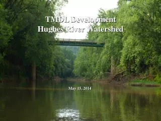
Chowan River TMDL Development and Source Assessment Tidewater Area October 20, 2004. Watershed. TMDL Steps – Tidewater. Monitoring/Listing - Identification of Water Quality Problem. Source Assessment – Locating potential contributors of pollutant in watershed.

E N D
Chowan River TMDL Development and Source Assessment Tidewater Area October 20, 2004
TMDL Steps – Tidewater • Monitoring/Listing - Identification of Water Quality Problem. • Source Assessment – Locating potential contributors of pollutant in watershed. • Modeling – Examining the movement of sources from the land to the water. • Allocation/TMDL – Use the model to determine the load reductions necessary to achieve water quality goals.
Historical Water Quality Data Analysis Fecal Coliform Concentrations
Enterococci Data 1Violations based on Enterococci instantaneous standard (i.e., 104 cfu/100 ml)
Source Assessment • Livestock • Permitted discharges • Wastewater treatment facilities • Human • Biosolids • Pets • Wildlife
Permitted Discharges • Chlorine fecal coliform translator • Historical averages (DMR) for calibration period • Design values for allocations • Direct application
Population, housing units, and onsite treatment system based on U.S. Census Human Source • Sanitary Sewer • Loading rates • Exfiltration • Overflows • Land-applied / direct deposition • Loading type • Proximity to stream
Septic Systems Failure to soil surface throughout year Lateral movement continuously to stream Straight Pipes Direct continuous input into stream Biosolids Land-applied Human Source
Pet Source • Population/household based on literature values, veterinarians, and animal control • Translated to housing units based on U.S. Census • Land-applied
Distribution of waste Pastured Confined, waste collected, spread Direct deposition to the stream Seasonal varying applications Livestock Source • Population • Virginia Agricultural Statistics • Consultation with SWCD, NRCS, VADCR, and VCE • Watershed visits
Population Animal densities from VDGIF biologists Habitat from literature values Distribution of waste based on habitat Land-applied Direct deposition to the stream Seasonal variations based on migration patterns and food sources Wildlife Source
Bacterial Source Tracking • Antibiotic Resistance Analysis (ARA) • Differentiates the sources of bacteria based on bacterial resistance to antibiotics
Modeling • Hydrologic model • Runoff model • HSPF • Water Quality model • Tidal/Estuary model • CE-QUAL-W2 • Model Calibration and Validation • Based on data availability, period of interest
Sewer Overflows VPDES Permit Septic Failures Parking Lots Straight Pipes Livestock in Stream Pets Lateral Flow from Septic Systems Biosolids Application Wildlife on the Land Wildlife in Stream Pastured Livestock Conceptual Model • Mathematical Representation • Overland • Direct discharges • Withdrawal
Hydrologic Modeling Components • Climatic data • Land use • Topography • Soils • Stream channel characteristics • Point source discharge/withdrawal • Flow data
Water Quality Modeling Components • Sources • Fecal production • FC densities • FC distribution • Delivery Mechanisms • Direct • Land-applied • Temporal Variation
Regulatory Voluntary Clean Water Cost Share Improved Water Quality And then: • Public Meeting 2 (Date?) • Public Meeting 3 (Date?) • Public Review • Submit to EPA • State Approval • Implementation Plan Development • Implementation