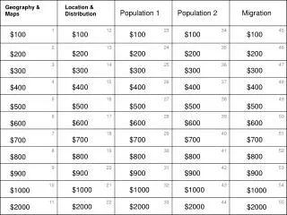
Download
1 / 69
710 likes | 980 Views
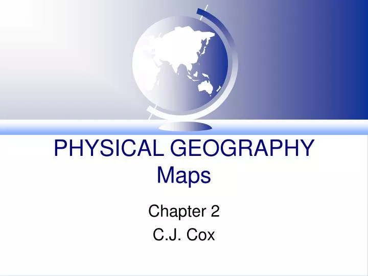
PHYSICAL GEOGRAPHY Maps. Chapter 2 C.J. Cox. Chapter 2 Concepts. Key properties of maps Great Circles Map Projections Scale Latitude & Distance Longitude & Time Magnetic North Township & Range ( Survey System) Contour Maps Remote Sensing. Key Terms.

E N D
PHYSICAL GEOGRAPHYMaps Chapter 2 C.J. Cox
Chapter 2 Concepts • Key properties of maps • Great Circles • Map Projections • Scale • Latitude & Distance • Longitude & Time • Magnetic North • Township & Range ( Survey System) • Contour Maps • Remote Sensing
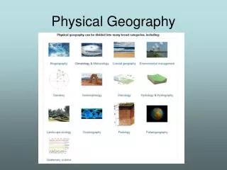
Key Terms • Map: a flat representation of a globe • Cartography - the art and science of mapmaking
Chapter 2 Concepts • Key properties of maps • Great Circles • Map Projections • Scale • Latitude & Distance • Longitude & Time • Magnetic North • Township & Range ( Survey System) • Contour Maps • Remote Sensing
4 KEY PROPERTIES OF MAPS Shape Area (size) Distance Direction
Key Terms • Conformal Map - shows correct shape • Equal Area Map - shows correct area • Rhumb Line - line shows correct direction • Great Circle - the largest circle that can be drawn on a globe. This circle divides the globe into two halves and is the shortest distance between any two points.
Chapter 2 Concepts • Key properties of maps • Great Circles • Map Projections • Scale • Latitude & Distance • Longitude & Time • Magnetic North • Township & Range ( Survey System) • Contour Maps • Remote Sensing
Key Terms • Great Circle - the largest circle that can be drawn on a globe. This circle divides the globe into two halves and is the shortest distance between any two points.
Key Terms • Rhumb Line - line shows correct direction
Chapter 2 Concepts • Key properties of maps • Great Circles • Map Projections • Scale • Latitude & Distance • Longitude & Time • Magnetic North • Township & Range ( Survey System) • Contour Maps • Remote Sensing
Map Projections • Projection: The system used to transfer locations from Earth’s surface to a flat map. • A projection of an image onto another surface • either a cylinder, a flat plane or a cone • 3 basic types of projections • cylindrical projection • planular projection (also known as azimuthal) • conical projection
CYLINDRICAL PROJECTION used by navigators to show direction Meridians run north & south Parallels run east & west
Cylindrical Maps are conformal maps they conform to the correct shape
CONICAL PROJECTION used for Mid-Latitude Maps True Area (between the standard parallels) Also referred to as equal area maps
PLANULAR PROJECTION used by pilots Shows Great Circle Routes
ROBINSON PROJECTION Compromise projection
Chapter 2 Concepts • Key properties of maps • Great Circles • Map Projections • Scale • Latitude & Distance • Longitude & Time • Magnetic North • Township & Range (Survey System) • Contour Maps • Remote Sensing
SCALE • Scale: the relationship between units on the map and actual distance on the ground • Written Scale: one inch equals one mile • Linear Scale: |---------|---------|----------| • or Graphic Scale • Representative Fraction: 1:63,360
Chapter 2 Concepts • Key properties of maps • Great Circles • Map Projections • Scale • Latitude & Distance • Longitude & Time • Magnetic North • Township & Range ( Survey System) • Contour Maps • Remote Sensing
Latitude & Distance • Earth’s Circumference 24,840 miles • 24,840 divided by 360 degrees of a circle • One degree equals 69 miles • One degree can be divided into 60 parts or minutes • 69 miles divided by 60 equals 1.15 miles • Therefore one minute equals 1.15 miles • One minute is a nautical mile (1.15 miles)
Latitude & Distance • One minute can be further divided into 60 seconds • One minute or 1.15 miles divided by 60 equals 102 feet • Therefore one second equals 102 feet • WHAT IS THE DISTANCE SHOWN ON A 15 MINUTE MAP?
Chapter 2 Concepts • Key properties of maps • Great Circles • Map Projections • Scale • Latitude & Distance • Longitude & Time • Magnetic North • Township & Range ( Survey System) • Contour Maps • Remote Sensing
Chapter 2 Concepts • Key properties of maps • Great Circles • Map Projections • Scale • Latitude & Distance • Longitude & Time • Magnetic North • Township & Range ( Survey System) • Contour Maps • Remote Sensing
Magnetic North • The earth holds a mass of liquid, fluid mass of iron around the solid inner core • This generates a powerful magnetic field within the earth that is generated into outer space
True North = Geographic North or North Pole Magnetic North = where the compass points to 76N 102 W
Declination - the difference between magnetic and geographic north 17 E
Terms • Isogons - lines connecting points of equal magnetic variation away from the geographic north • Agonic Line - points along a line where there is no magnet variation or declination from the geographic north
Chapter 2 Concepts • Key properties of maps • Great Circles • Map Projections • Scale • Latitude & Distance • Longitude & Time • Magnetic North • Township & Range ( Survey System) • Contour Maps • Remote Sensing
Township & RangePublic Land Survey System • A rectangular grid system adjusted to the geographic grid • East west lines are surveyed and coincide with parallels of latitude • prominent parallel is known as the base line • Vertical divisions are called ranges • prominent meridians are called principal meridians
Chapter 2 Concepts • Key properties of maps • Great Circles • Map Projections • Scale • Latitude & Distance • Longitude & Time • Magnetic North • Township & Range ( Survey System) • Contour Maps • Remote Sensing
Contour Maps • Maps showing lines that indicate locations of equal elevations