Download
1 / 19
190 likes | 271 Views
CARTOGRAPHIES OF SEGREGATION From Snapshots to Processes and Trajectories. Flávia F. Feitosa (UFABC) Antônio Miguel V. Monteiro (INPE). XIV Brazilian Symposium on Geoinformatics (GEOINFO 2013), November 24 th – 27 th , 2013.

E N D
CARTOGRAPHIES OF SEGREGATIONFrom Snapshots to Processes and Trajectories Flávia F. Feitosa (UFABC) Antônio Miguel V. Monteiro (INPE) XIV Brazilian Symposium on Geoinformatics (GEOINFO 2013), November 24th – 27th , 2013.
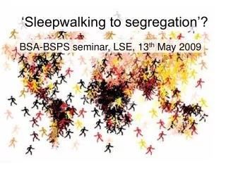
Almost 10 years ago… A Question:How to measure residential segregation? Photo: Tuca Vieira
Many challenges… • Spatial Measures: able to go beyond the limits of areal units • Capture Different Scales of Segregation
Evenness/Clustering: Balance of the population groups distribution Exposure/Isolation: Chance of having members from different groups living side-by-side Many challenges… • Spatial Measures: able to go beyond the limits of areal units • Capture Different Scales of Segregation • Global and Local Measures • Interpretation of Measures / Validation: random permutation tests • Different Dimensions of Segregation Reardon and O’Sullivan (2004)
EVENESS/CLUSTERING: DISSIMILARITY INDEX SLIDE: Fred Ramos
EXPOSURE/ISOLATION: ISOLATION INDEX (POVERTY) SLIDE: Fred Ramos
New challenges: From snapshots to processes… The process matters!!! Bottom-up Simulations Agent-Based Modeling
MASUS Multi-Agent Simulator for Urban Segregation
MASUS Multi-Agent Simulator for Urban Segregation
0.19 0.19 We keep monitoring processes through snapshots… ISOLATION AFFLUENT HOUSEHOLDS Real Data (2000) Initial State (1991) Simulated Data (1991-2000) 0.15
Why not Trajectories? How could we represent time-space trajectories of segregation? • We need common areal units: cellular spaces • Even with cellular spaces, is it possible to compare local segregation indices computed for different years? • Is it possible to establish typologies of segregation trajectories? Types of Trajectories: • Cell-based / Pattern-based • System-based???
CARTOGRAPHIES OF SEGREGATIONFrom Snapshots to Processes and Trajectories Flávia F. Feitosa (UFABC) Antônio Miguel V. Monteiro (INPE) XIV Brazilian Symposium on Geoinformatics (GEOINFO 2013), November 24th – 27th , 2013.
Construção de Índices Espaciais • Índice de Dissimilaridade Generalizado – • Mede a diferença entre a composição populacional local e a composição populacional da cidade como um todo • Varia entre 0 e 1 (máxima segregação) • Dimensão Dispersão/Agrupamento
Construção de Índices Espaciais • Índice de Segregação Residencial – • . • Cidade segregada: alta • Proporção da que é explicada pela • Dimensão Dispersão/Agrupamento
Construção de Índices Espaciais • Índice de Exposição do grupo m ao n - • Proporção média do grupo n nos locais onde habitam indivíduos do grupo m • Depende da composição populacional da cidade • Dimensão Exposição/Isolamento
Construção de Índices Espaciais • Índice de Isolamento do grupo m - • Caso particular do índice de exposição • Proporção média do grupo m nos locais onde habitam indivíduos do grupo m • Dimensão Exposição/Isolamento
Densidade Populacional Dados Agregados Dados Discretos X Contínuos • Vantagens dos índices baseados em densidade populacional • Evita ênfase visual a áreas pouco ocupadas (grandes polígonos)