Download
1 / 9
90 likes | 140 Views
Learn about Virginia Port operations, modeling, teamwork skills, GIS, spreadsheet analysis, and port-related careers. Explore VPA's history, vision, overview, and future developments like Craney Island Terminal. Enhance skills in modeling, animation, rendering, and data analysis. Access resources for geolocation and tidal information.

E N D
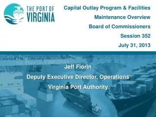
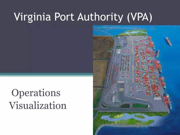
Virginia Port Authority (VPA) Operations Visualization
Objectives • Develop an awareness of Virginia Port operations and economic impact • Develop modeling, animation and rendering skills • Develop teamwork skills • Explore Geographical Information System (GIS) information • Analyze spreadsheet data • Explore port related careers
VPA History • Prior to 1971, seaport terminals were managed separately by individual Hampton Roads cities of Norfolk, Portsmouth and Newport News • Virginia Port Authority was created by an Act of the General Assembly and unified port operations • Portsmouth Marine Terminal (PMT) • Newport News Marine Terminals (NNMT) • Norfolk International Terminals (NIT)
Vision Statements • Port of Virginia primary gateway for international cargo transported through Mid-Atlantic and Mid-West regions. • Virginia Port Authority - promotes economic development and stimulates job growth through international trade.
VPA Overview • Port-related business provides over 343,000 jobs yearly • $13.5 billion in payroll revenues, and • $1.2 billion in local tax revenues. • Since 1996, • warehousing and distribution investment has increased by over $416 million • employed over 12,000 people in Hampton Roads. • The Virginia Inland Port, located in Front Royal Virginia, has attracted 24 warehousing and distribution centers • providing a total income of $599 million with over • 6 million square feet of space • over 7,000 workers. • Wal-Mart, Target, Home Depot, Dollar Tree, Lillian Vernon, and Cost Plus - distribution facilities in the Commonwealth because of a world class port facility and structure.
Background - Facility Locations • 3 marine terminals located on the Harbor of Hampton Roads with 50 foot deep-water channels • No bridge obstructions in the channels leading to the Authority’s terminals • Served by 4 railroads • – Norfolk Southern • – CSX • – Norfolk and Portsmouth Belt Line • – Eastern Shore • Close proximity to major Federal Interstates • (I-164, I-264, I-464, & I-664) and State highways
Future Development • Craney Island Marine Terminal is the future of the VPA • $2.2 billion construction cost, including $400 million for dike and levee construction • Feasibility study by the VPA and the US Army Corps of Engineers complete • Anticipated to be constructed in four separate phases • Phase I includes two years for design, two years to construct levees, two years to fill and four years for terminal construction • Anticipated opening of Phase I is 2017
Skills Set developed • Modeling, animating and Rendering • Working with spreadsheets
Resources • GeoHack - Craney Island Light • http://stable.toolserver.org/geohack/geohack.php?pagename=Craney_Island_Light¶ms=36.892_N_76.337_W_type:landmark • Tides for Craney Island Light (Elizabeth River)